Back home!

Monday, June 11, 10:30, we sailed into our marina, Regent Point Marina in Topping, Virginia.  Sunday afternoon, we sailed through the South tunnel of the Chesapeake Bay Bridge Tunnel, and then to just outside Little Creek, where we talked a power boat into giving Peter a ride into shore, so he was able to catch a flight home for a meeting Monday morning.  Around sunset, we started our sail up the Chesapeake Bay to home, a mere 50 nautical miles.  Within a couple hours we were in the midst of a bad thunderstorm which thrashed us around a bit and lasted a bit less than an hour.  After that, we had good South winds to drive us up the bay, and when we neared the Rappahannock River, the wind shifted East to drive us up the River and into the marina.

We will post more detail here after we have a few days to decompress.  Overall, this has been a good trip.

Days five, six, and seven: Halfway!

Monday, Brisk 16 knot wind moving us along at hull speed. We should make good time tomorrow too with wind decreasing a bit during the day Tuesday. We did 105 miles yesterday and 48 Saturday. Saturday, the wind died for a while, so we went swimming in 80 degree water 17,000 feet deep.
Found a 2 inch long flying fish on deck; too small for breakfast. There have been four Tropic Birds following our boat for a couple days. They are seagull size, white with black highlights, and have a long thin tail feather. They have a call that sounds like a pulley that needs grease.
Sunday night at 8:00, we were equidistant from Puerto Rico, and our home marina. Halfway!

Third and fourth days on the ocean blue

We made 135 miles yesterday and 117 today (noon to noon). Wind is way down, so we will do much less tomorrow. Wind is around 5 knots, and we are drifting along at around 2 knots. The sea is so flat, it is hard to measure the wave height. Sailing is so smooth, we have been reading, doing maintenance, and some navigation exercises. We saw two commercial ships yesterday, and one last night. During the dawn watch, a small sparrow sized bird with yellow highlights, landed on deck for a rest.. 20 minutes later he took off. Good luck to him, we are well over a hundred miles from the nearest land.
It is a beutiful day with a blue sky, deep blue water. We have a full horizon all the way around with absolutely nothing there but us, and puffy clouds in the distance. I dropped my flip phone in the water this morning. We are in 18,000 feet of water. If the phone falls through the water at 1 foot per second, I figure that it will take 5 hours to reach the bottom, or about 2:00 this afternoon.

Second day of offshore trip home

From noon to noon (24 hrs). we sailed 125 miles, a bit slower than yesterday. The wind is a bit less, and the waves are too. Trade winds are forecast to moderate more in the next two days, so we should be slowing down more, giving us a chance to try out our big drifter sail. Beautiful weather! Full moon at night. Lots of flying fish.. W are starting to feel like ourselves again.

First Day Out Heading for Home

We left our marina at 5:00 today: My high school friend,Peter Mueser, Salli and I. We are planning to do 3 hours on and 6 hours off, a nice change from 3 and 3. To noon today, we made 115 GPS miles. Much better than I expected. Seas are a bit rough. No one is sick, but no one is eating much today. Beautiful sunny sky and cobalt blue sea with occasional flying fish flying from wave to wave. Since leaving PR, we have seen 2 commercial ships and no pleasure craft.

Boqueron to Fajardo

Boqueron to Cabo Rojo
Tuesday, May 8: We made the short 7 mile sail (under sail) to Cabo Rojo in the afternoon, anchoring near the point in fairly rolly conditions. Up at 2:00 AM (North Star up at 4:00), and off for La Parquera and Gilligan’s Island.

Gilligan’s Island
Wednesday, May 9: On the way to Gilligan’s Island, the motor quit again, and we sailed into the anchorage. After consulting by phone with my boatyard mentor, Paul Anderson, we decided that the 41 year old, salt water cooled motor, had just filled up with rust, and overheated, causing the pistons to seize. Time for a new engine, and time to baby this one. We decided to just use it to get into and out of anchorages, and to sail the rest of the time. 29.5 nm.

Gilligan’s Island is named after a 1970s TV show. The guide books say there was a fisherman who looked like Gilligan who started a tourist business based on tours of the island. This is not where the show was filmed. Capitalist pressures have caused the island to be renamed, and most charts show its new name.

Ponce
Thursday, May 10 2:00 AM: again, we sailed off our anchor and off to Ponce (Pronounced Pon-say). We sailed the whole way, and started the engine to get into the Ponce anchorage. No luck. The engine ran for a minute, developing no useful power and then shut off. We are officially without an engine. We sailed into the anchorage, although we didn’t go very far into the harbor. We stayed in Ponce for two days, sharing an Uber with North Star (and sharing their dinghy) to get to a McDonald’s and a WalMart. Arrived 9:00 AM, 32.5 nm.

Salinas
Saturday, May 12. Same routine to Salinas. Left at 2:30, tacking back and forth to Salinas. Since we are sailing onto and off our anchor, we need to be very careful not to sail into a harbor that we can’t sail back out of again. We can sail north, south, and west, but not east. Salinas has a north-south approach to it’s harbor, and I was game to give it a try, but North Star decided to anchor outside the harbor, and that was fine with us. Salinas is reported to have good support services for cruisers, but we didn’t go ashore. Arrived 10:00 AM, 32.1 nm.

Puerto Patilla
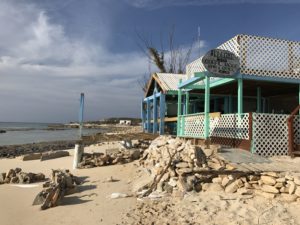
Sunday, May 13. Same routine again: Out at 2:15, tacking all night and sailing from the south into the anchorage. We made deal with North Star offering to treat them to dinner if they would dinghy us into town. We found a nice, but hurricane damaged town. There was only one operational, but good restaurant, and had a nice meal; our last one together. Arrived 11:20, 36.3 nm.

We have a compact Porta-Bote folding dinghy which is a bit of a bother to set up and tear down. We need to drag it onto the foredeck open it up, pin three bench seats in place, toss it into the water, get oars ready, optionally installing a small outboard motor. This can take over 30 minutes to set up and 30 minutes to tear down, usually when we are tired, so often we just decide to stay on Olive Oyl and enjoy the town from a distance. North Star has an inflatable dinghy which they haul up on deck, but there is some assembly required for them too.

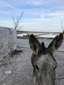
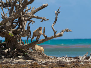
Cayo Santiago (Monkey Island)
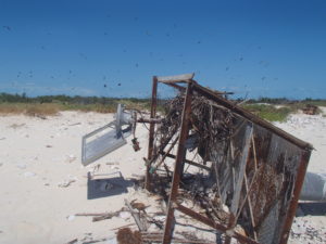
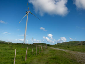
Monday May 14: Same routine again: up at 2:00 bound for Cayo Santiago, a small island on the east coast of Puerto Rico. We spent about 6 hours tacking the first 7 miles. As we rounded a series of points, we were able to work the wind gradually to our starboard side, and we were finally able to sail our last leg without tacking. We sailed into the lee of a little island which still had evidence of hurricane damage. This island had been used for monkey research since the 1930s. It had been populated with Rhesus monkeys imported from India, and the social interactions of the monkeys have been studied by scientists. Our internet research indicated that the monkeys had weathered the storm and most had survived, but we couldn’t see any. We found later that they were still on the island. We were too far out to see them.  We looked out on a vista of perhaps 15 wrecked power windmills.  Arrived 12:00 noon, 37.5 nm.

About tacking. It should come as no surprise that it is impossible to sail east into a wind coming from the east, however it is possible to sail to the northeast or to the southeast, and this fact makes it possible to sail a modern sailing vessel to windward. But there are costs, and those costs are additional distance, and reduced speed. Imagine you are at one corner of a large square room. You need to get to the opposite corner, but you are not allowed to go directly. You are obliged to travel down one of the walls next to you (either one) to the next corner, and then down the next wall to your destination. It turns out that you have to go 40% farther when you do this. For you engineers, this is the square root of 2, or two times the sine of 45 degrees. Imagine again that there are obstacles along the edge of the room that slow you down, and that the room isn’t really square, rather it is diamond shaped, causing you to travel even farther than if it was square. This is what tacking can be like. The last 4 legs of our journey have all been about 22 miles long, but the distance displayed by our electronics has generally been around 35 nautical miles. To make matters worse, our speed has been minimized by our close angle to the wind. When you are out for a daysail, tacking can be fun. When trying to get somewhere on a windy day with big waves, it can be miserable.

Marina Puerto del Rey
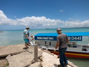
Tuesday, May 15: We got a late start the next day, mostly because we had difficulty identifying our next stop. We were looking for a marina we could stop at for two weeks while our son and his wife (Josh and Jen) visited us, and while we waited for a crew member (Peter Mueser) to join us. We discovered that east coast Puerto Rican marinas are VERY negative about sailboats sailing into them without engines. We were obliged to get a tow, and that tow turned out to be SeaTow for $375. Now we do have towing insurance with SeaTow’s competitor, TowBoatUS, and much of our morning was spent on figuring out how to get our company to pay the other company, and how to get towed back out two weeks later. We left Cayo Santiago around 11:00 and made it into Marina Puerto del Rey around 5:00PM. SeaTow came out and helped us in the last 1000 feet, a 15 minute job. They were very competent and specialize in making nervous boaters feel like things are finally under control. 26.5 nm.

OLYMPUS DIGITAL CAMERA

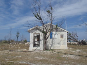
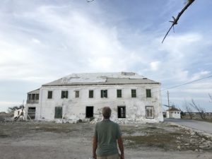
We paid for 2 weeks at $37.50 a day, and got a nice slip in a huge marina that has 1000 slips, but no pool. 4 days later, Josh and Jen came to visit. We visited El Yunque, said to be the only National Park rainforest in the USA (there is another in Alaska, which also claims to be the only one). We visited the two ancient castles in San Juan, Castillo San Felipe del Morro and Castillo de San Cristóbal. Both were huge and very old (by American standards).

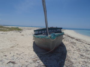
We also booked a tour of Cabo Santiago (Monkey Island) with Captain Paco, an enthusiastic septuagenarian with good English skills. There was a problem however, Captain Paco had burned his arm, and he had a lame foot, and he needed some kind of help to get his boat ready. We decided it would be fun to go and try to help him, even if we couldn’t take the tour. He was clearly an interesting guy, and it was only about a 15 mile drive. When we got there, he gave me detailed instructions about how to row out to his boat, start it (the starboard engine only), cast off the mooring, haul in the anchor, and pilot it into the hurricane damaged dock. Where he got the trust that a stranger could do this, is still a mystery. It was the first time I ever captained a boat with more than 6 horsepower, but I accomplished the task with no damage to the boat or to my pride. We took the tour, did some snorkeling at a shipwrecked barge, saw some fish and starfish. Got close enough to the beach to see monkeys and monkey support personnel, and had a conch horn blowing lesson. When we got back to the dock, Paco’s regular helper had gotten home from high school, so we didn’t need to take the boat out to its mooring. A great relief to everyone.

OLYMPUS DIGITAL CAMERA

What to do about Olive Oyl’s engine. Replacing a boat engine is not like replacing a car engine. Most used engines are in no better condition than ours was before its failure. Typically, a “repower” involves installing a brand new engine from some other manufacturer, in this case a Beta Marine diesel with V-drive transmission. This is much like installing a Hyundai engine in a Chevrolet truck. It involves a great deal of knowledge, care, and hand fitting. Not, in my opinion, something that should be undertaken by strangers in a strange land, even if it is part of the USA. This endeavor is also very expensive and may cost as much as the boat will be worth after the work is done. After much discussion, we have decided to sail Olive Oyl back to Virginia, where our support network is, sans motor, taking the 1250 mile direct route in the blue water. The plan is to leave Monday afternoon, May 28th, a few hours after my highschool friend, Peter Mueser gets here to help us crew. it should take about 2 weeks. The experts all agree that the best time to make this trip in this direction is in May, so the conditions are as good as they can be. Weather info indicates that winds should vary from 20 down to perhaps 5 kts from a variety of directions, but NOT FROM AHEAD. It promises to be a civilized, if long, and possibly hot trip. Keep an eye on this blog for location reports (click the tiny box at the top of this page). We will post them daily if possible.

In the meantime, we are getting ready for our long trip. Cleaning up, doing laundry, fixing a short list of things, sealing up the chain pipes, scraping barnacles off the bottom, provisioning, and selling 15 gallons of diesel fuel.

Samana, DR to Boqueron, Puero Rico

Samana to Punta Macao
Sunday, April 29: We checked out of Samana with Comendante Sheppard. It is an irritating fact of life in the DR, that foreign vessels have to check out and in of every port. Nearly all other countries only require checking in at the port of entry and checking out at the port of departure. In fairness to the Dominicans, there is a smuggling problem: Humans from Haiti, and drugs through the DR to Puerto Rico to the Continental USA. We left the Marina, along with North Star and a catamaran, Prowler Cat, at 5:00 PM on the 30th, the latest the Comendante would allow, and had an uneventful, but bumpy, sail to Punta Macao. We arrived early in the morning, and were soon visited by Navy officials checking our papers. Everything was in order. Punta Macao was, briefly, a quiet anchorage with a long beautiful beach. Two boats arrived before us, Prowler Cat, and North Star. Prowler Cat got in much earlier than us, but North Star was just ahead of us. They are a faster boat than us, but they spent the night tacking back and forth, where we motored in a straight course into the wind. Before long, the beach started to fill up with many more people than we expected on a Monday, and we discovered that it was the DR equivalent of labor day. Loud music all day long while we were trying to get some sleep. It wasn’t too bad for us, but Prowler Cat, having anchored closer, got the worst of it, They even had two groups of partiers swim out to their boat, one, a group of Russians, climbed aboard uninvited. We wondered aloud: “In what culture is this acceptable behavior”. 62 nm.

Punta Macao to Boqueron, Puerto Rico (Mona Passage)
Tuesday, May 1, morning. We left The Dominican Republic according to a formula we used for all our future legs. Being the slower boat, we left at midnight and our buddy boats left two hours later. This is a long leg of about 100 miles, and we needed to time it right. Weather reports indicated this would be a good day to make this trip, as there was a substantial wind shadow from Puerto Rico along our route. The trick is to start early in the morning and get out to the wind shadow by sunrise, and to proceed across during the daylight hours, arriving after dark in Puerto Rico. Our sail went according to plan, starting rough, settling down to less than 10 knots during the day, and picking up as we approached the coast of PR. We motorsailed hard, tacking back and forth a bit, and around 8:00 PM, Salli noticed more smoke than usual from the engine. A minute later the engine stopped. We were in deep water with little wind, and small waves, so there was no urgency. We decided to continue on under sail which took us several hours. There was a narrow entrance we need to motor through to get into Boqueron Harbor.  Tthe engine started and ran fine for several minutes as required. We anchored at 4:00 AM. 131 nm.

Boqueron, Puerto Rico

We spent nearly a week here, trying to figure out what the problem was with the motor, and waiting for the wind to settle a bit. Boqueron is a nice town with a tourist economy and a nice beach. There was no place to check in, so we had to get a taxi to take us to nearby Mayaguez. It was nice to be back in the USA again with Border Control agents with bulky bulletproof vests. Salli got them to stamp her passport, something they normally don’t do.

Eventually, we got tired of waiting, and started our journey across the south coast with our friends in North Star.

Luperon to Samana

Getting to Puerto Rico

In general, it is hard to get to Puerto Rico from the west. The trade winds blow from the east, and can be greater than 15 knots, sometimes a lot greater. As luck would have it, the first part of May had greater than normal wind which made it hard to get to the east.  There is a book called Passages South by Bruce VanSant, and he gives a series of formulas to make the journey easier. The simplified version is you wait for the forecast wind to be below 15 knots from the SE, and make your passages during the night when the land blocks the wind in various ways. The down side of this method is that we sailed past the beautiful coast of the Dominican Republic and Puerto Rico when it was dark and we didn’t get to see much of it. Additionally, on several occasions, our weather sources indicated high winds for an extended period. We got tired of waiting, and went anyway. Our impatience caused us some discomfort but little danger.

Luperon to Rio San Juan
Wednesday April 25 6:55PM to 7:00 AM: This was an odd leg, since we saw three small fishing boats. They seemed to be open boats with an outboard motor and two or three men. They had no running lights, but alerted us of their position using a flashlight. Normally cruisers ponder the mysteries of getting run over in the middle of the night by some larger vessel. It was odd to be on the other side of this dilemma. 56.8 nm

Rio San Juan was a nice quiet anchorage. We slept several hours during the day and waited for nighttime to start on the next leg. We saw some small fishing boats. At one point there were three men dressed solid color t-shirts, one red, one blue and one yellow, possibly vacationers, paddling a medium size row boat. It seemed to have a bad oarlock, since one of the men was rowing, and one of the others was using the other oar like a paddle. They were making progress, but had trouble keeping a constant heading.

Rio San Juan to Samana.
Thursday April 26: This trip started with rounding Cabo Viejo Frances, which looked easy on the chart, but took hours. The seas were rough, the wind was strong, and the Cape had a rounded shape which meant that going a 1/2 mile offshore to find smoother seas, would cause us to sail an additionally 1.5 miles distance. We “sucked it up” and and took the beating on the shorter route. Our original plan was to stop at Puerto Escondido, a protected anchorage much like Rio San Juan, but when we got close, we decided to try to make it all the way to Samana, figuring that if it got rough,we could do a u-turn and go back to Escondido. The sun rose, and we continued on to Samana, passing a series of interesting rocky bluffs that we were able to see since it was daylight. Passing the last of these points, we were able to shut the engine off, and sail the last 8 miles. Arrived 2:00 PM, 86.8 nm

A note about motorsailing:  We motored most of this leg, and most of several of the legs to follow. When you motor in these conditions, you are powering into wind and waves, and there are two things you can do to make conditions more bearable. First, you can raise some mainsail. This helps stabilize the boat and suppresses the side to side motion. Second, you can make sure the boat is not headed directly into the wind, so there is some small addition to the speed provided by the sail. Practically, this means making sure the boat is going 20- 30 degrees to the right or left of the wind. If the route is directly into the wind, then it helps to tack from side to side every now and then, making a zig zag course, confusing all non-sailboaters who see you doing it.

Samana, Marina Puerto Bahia.
We stayed here two nights. We were advised to go here and pay for a slip rather that to anchor in Samana Harbor. Immigration (Comendante) is easier to deal with here, and there have been some theft problems at the harbor. Marina Puerto Bahia is a very nice and new facility. For $30 per night, we had a slip, showers, three pools, exercise equipment and access to several restaurant.  It was here that we met Steven and Carina of North Star, a 42 foot Catalina. North Star became a “buddy boat” for a week or so. We shared weather information with them, and they, being more conservative about using fuel, encouraged us to do more sailing and less motoring. An exercise that would become very useful to us in a few days.

Luperon

We spent a month here from March 23 to April 25.  We had a great time in this mangrove forested harbor in a farming community.   Our daughter and granddaughter, Emily and Matilda visited us during this time.  Most of the rest of the time, we waited for weather and did local touring.  Let this be a placeholder to be updated later.  We have over 35 pictures, which is part of the problem, since it is hard to upload that much data here.

Turks and Caicos to Dominican Republic (French Cay and Salt Cay)

Birds flying around hurricane damaged light

Monday March 19, 2018

We departed in the late morning for French Cay, a short trip of 19 miles. When we got there, we went ashore and found an abandoned boat with the name of “Ser Vice Plus” and thousands of birds of 3 or 4 species, clearly nesting in the middle of the cay, and flying about, and making noise.  Initially, we thought they were disturbed by us walking on the beach, but when we got back to the boat, they still behaved the same. We walked around the whole cay which took about 40 minutes, finding some nice shells.

Ser Vice Plus with Olive Oyl in the background

The boat, “Ser Vice Plus” was especially interesting. It was crudely built of rough lumber, nailed together with the same kind of steel nails you would use to build a house, probably 8 d sinkers. It was caulked with what may have been standard latex caulk;  the paint was still bright.  There was only one place where I could see daylight through the hull. It looked like it would float if put to sea again. It had had a bowsprit at one time which was cut off, a short 8 foot mast, and a very crude mount for an outboard motor. A look inside revealed backpacks and lots of nice clothes and shoes, most of them children’s. My theory was that this was a refugee boat from Haiti that wound up on this island by accident or by plan. My French isn’t good enough to know the difference between Service and Ser Vice (If anyone has an idea, please post it to this blog). I did an internet search, but didn’t come up with any historical information about such a boat being apprehended or coming to grief. There is quite a large Haitian population in The Bahamas and in the Turks and Caicos. They tend to get the lower pay jobs, and there is quite a bit of animosity between legal residents and Haitian refugees, just like in the USA. Cuba, T&C, and the Bahamas are the closest countries downwind from Haiti. When we were in Marsh Harbour, an arsonist set fire to the Haitian shantytown, called Mudtown. No one was killed, but about 100 homes (shacks) were destroyed.  As a side note, it seems the Haitians receive quite a bit of used clothing from US aid organizations. The Haitian’s don’t have much, but they do have nice clothes, it seems. They even export quite a bit to the Dominican Republic.

French Cay with Olive Oyl at anchor

We went for a quick swim, rowed back to Olive Oyl at our quiet anchorage, did a quick internet search on French Cay, and found out that it was a bird reserve and going onshore without a permit was prohibited. Oh well, we don’t think we did it any damage.

The next morning, March 20, we got up an hour and a half before sunrise and left for our 58 mile trip across the shallow T&C banks to Salt Cay. This was largely a trip that had to take place during daylight hours, because of the potential of encountering coral heads. The chart was full of dotted lines with the words: “Unsurveyed area” on it. We didn’t have any trouble, but we draw only 4.5 feet. Most large sailboats draw 6 feet or more. We anchored at Salt Cay about 2 hours before sunset (perfect), rowed in to shore and took a look around.

Telephone Equipment Building: “Authorized Access Only”

Salt Cay became one of our favorite places. It is very rough, having suffered from the two big hurricanes of 2017, Imra and Marie. Palm trees were gone. The telephone lines had been torn from the poles, and were still laying on the ground. We were told that the phone company was not going to replace these wires, requiring the whole island to rely on cell coverage that seemed to be working well most of the time. The power lines had already been replaced.


The island had also been damaged by 18 foot waves a few weeks before that came down from the recent huge storm off the coast of New England (discussed in the “Rudder Cay to Georgetown” post below). There were dozens of donkeys and cows roaming the island. Many of the homes were vacation rental units, and many were partially damaged, (mostly missing roof shingles). It seemed like it might be a buyer’s market for real estate with a view of the Caribbean. There was a single restaurant which had lost its patio in the 18 foot waves, a dive business, a whale watching business, some individual fishermen, and a few tiny stores run out of peoples homes.


The next day, we went for a walk to a beautiful white sand beach on the North coast of the island. At 11:00 we were the only people on this 1/2 mile beach overlooking turquoise water with coral reefs within swimming distance.

For over 200 years, Salt Cay had a huge family salt production business. Production stopped in 1955. There are still huge salt ponds separated with short stone walls. There are interesting canals, and most of the original buildings are still in place, some re-purposed. The most impressive is a huge white house that is built on top of a salt warehouse that has at least 15 foot ceilings. It is also one of the few houses in the world built with a pitched limestone (from Bermuda) roof, supported by wood frame. This roof has lasted about 200 years, and must be 6″ thick, but last Summer, the house suffered a direct hurricane hit which lifted thousands of pounds of limestone off the roof. We were standing in the street looking at the damage, and we noticed a workman up on the porch. We started talking and it turned out that he was Ian Dunn, a family member and part owner of the house. We talked for 20 minutes, and he was a fount of information about the house and history of the town. He runs a boat tour business and hopes to fix the house up, and has gotten quotes to fix the roof by putting all the good stones on one side, and replacing the other side with some kind of man-made stone substitute: many 100s of thousands of dollars. He remembers playing in the house when he was a child when it still had salt in the warehouse below. You can find more about this house by doing an internet search on “white house salt cay”

The next morning, March 22, we hauled anchor and headed out for Luperon Bay in the Dominican Republic. Humpback Whales have their calves at this time of year in this vicinity. We had until early the next morning to get to Luperon, a distance of 90 miles, so we had a few hours to spare, and we went looking for whales. We only saw one fluke in the distance and didn’t get close enough for pictures. Our overnight trip was long, but uneventful. We sailed most of the way. For a while, it looked like we might get in to Luperon before sunrise, but the wind decrease around 5 AM, and we had to motor for a bit to get in before the trade-winds picked up. We were met by the local “Papo” who helped us find our way into the anchorage and rented us a mooring for $2 a day (about 1/8 of what we paid in Marsh Harbor). With detours, this leg turned to be 107 nautical miles.