Friday, December 29, 2018
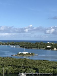
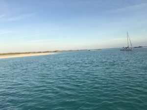
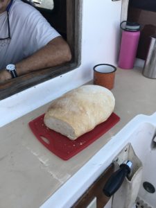
We left around 9, and after a short 5.1 miles, anchored outside of Hopetown Harbour on Elbow Cay. We dinghied to the Sailing Club dock, walked around, bought some still-hot bread, and went to a restaurant on the ocean side for lunch. There we ran into Mack again (see post above), and bought him a drink. Back to the boat around 3:00 when the winds picked up above 17 kt, so we decided to stay on the boat. We were anchored where our chart indicated “poor holding”, but we had no trouble while we were here.
Saturday, December 30
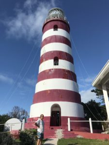
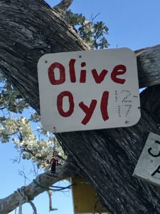
We dinghied into Hopetown and visited the red and white spiraled lighthouse. It claims to be the last kerosene powered lighthouse in the Bahamas, although there was a sodium vapor lamp hanging nearby, possibly for emergencies. We went over to the ocean side for a snorkel dive. Headed back to Olive Oyl for the short (8.4 nautical mile) trip to Marsh Harbour. We picked up a mooring, since we were expecting a blow, and were planning to leave the boat unattended the following week. We met up with Angie Wilson and went out for dinner at Colors by the Sea. Angie has known us and our boat project from the very beginning. We met her at Shipwright Harbor Marina, where we bought Olive Oyl (ex Marie). She has seen both the “before” and the “after” of Olive Oyl.
At this point, we would like to apologize for the untimely posting we have done on this blog. It was our original intention to make a slick presentation of text and pictures documenting our trip. This has turned out to be difficult due to the poor internet connections we have had with 2G internet service, and the fact that one of us does the pictures and the other, the narrative. We have decided to quickly catch up to the present, and to try to concentrate on keeping up to date at the expense of fewer pictures. We may add pictures to posts after we post them, so each post may evolve over time.
 Wednesday, December 27, We left Green Turtle Cay bound for Man-O-War Cay, two hours after low tide, and got out of Settlement Creek without touching bottom. Shallow draft vessels can take a fairly direct route, but deeper vessels must go out into the Atlantic, briefly, to go “around the Whale” We probably could have taken the shorter route, but the longer route was only a couple hours longer, and conditions were favorable for playing it safe. We got to Man-O-War Cay, anchored outside the Harbor and went into town where a fellow named “Mack”, told us where the dinghy dock was and where we should eat (Hybiscus). Man-O-War is a Loyalist town where much of the economy is based on boatbuilding and repair. We found a restaurant, ordered a pizza, walked around a bit and headed back to the boat. We had outboard trouble, and before I had time to do any troubleshooting, Mac showed up in his small fishing boat, and towed us back to Olive Oyl. It turned out that the fuel hose had come loose from the engine, a simple fix.
 Thursday, we went ashore again for a walk around town, and to mail a postcard. We were told that the post office was only open one hour on either Tuesday or Thursday. Lunch at Hibiscus, Showers, Laundry, and Dinner at the Marina. Back to Olive Oyl, planning to leave for Hopetown the next day.
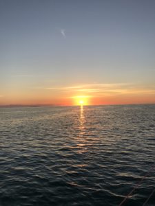


 Thursday morning we set sail across the Gulf Stream, a trip that was uneventful. 4-5 foot waves, enough wind to sail about halfway across. Dolphins, Flying Fish, and small Portuguese Man-of-Wars (Men-of War?) We got to the Little Bahama Bank after dark in the vicinity of White Sand Bank, where we decided to anchor rather than continue on overnight. Our anchorage was a bit rough, since the wind, current, and waves were all from different directions. It made sleeping a bit rough, although not impossible. We found out later that there was another boat, Aine (pronounced Anya) that was anchored nearby the same night. We saw their green light, but thought it was from a vessel underway.
