About Anchoring

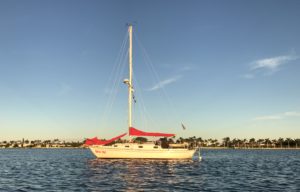
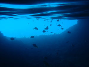
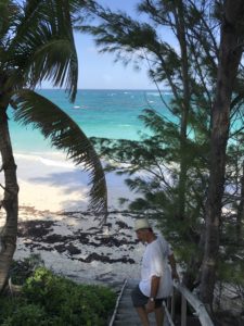
At anchor, Lake Worth, Florida

At its simplest, anchoring is the act of dropping an anchor overboard, and attaching it, with rope or chain, to the boat so it stays where you want it to stay.      However, there are layers of complexity to anchoring, mechanical, social, and philosophical that escapes the casual observer.

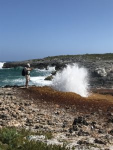
I love anchoring!  At the end of a tiring sail, I do the simple act of releasing the anchor from the bow, and by some metaphysical magic, suddenly, I am home, tethered to the sea bottom by chain the diameter of a pencil and rope the size of my index finger.  But, there is some strangeness to this.  Normally, the wind turns the sailboat in a circle around the anchor to point automatically into the wind.  Sometimes there is no wind, and the boat turns into the current.  Sometimes there is substantial current such as we encountered at Rudder Cay.  Sometimes there is wind and current, and the boat does some strange dance around the anchor chain where the boat points into the wind, but the chain leads sideways off the boat into the current, and only God knows where the dinghy will drift to.  Every time we look or go outside, we have to orient ourselves anew.  We might be pointing any direction.   Additionally, there is some risk that the anchor will move, dragged by the forces of wind and current, and there is some risk that another boat will drag down on us.   Suppose you went out your front door each morning, and had to decide which way your house was facing, if you had been dragged into the next block, and if your neighbor’s house was sitting on your front lawn.  This is what anchoring is like.

There is one more inconvenience called roll.  This is the movement of the boat in response to waves going through the anchorage, to the wakes of boats going through the anchorage, and to wind blowing on the boat.   Boat movement that would be unnoticeable when underway can be quite irritating when trying to sleep.  I cannot sleep if my head if flopping around from side to side, even slightly.  The only fix for this problem is to move to another anchorage.  Sometimes one can be found nearby, sometimes not.  We find that we can tolerate quite a bit of movement, but we have found visitors have had trouble with this movement.

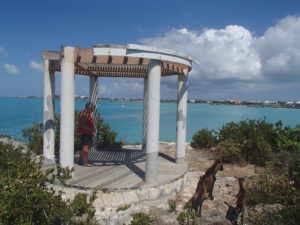
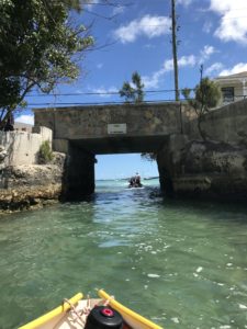
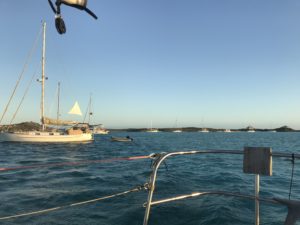
Ideally, when approaching an anchorage, you are the only one there, but in the Bahamas, this is seldom the case.  Often, you need to find a place amongst a multitude of other boats.  Specifically, you must find the best place.  For us, this place is close to the dinghy dock, since our dinghy is none too fast.  It should be out of the way of commercial boats (the mail boat for example), and it should be a sufficient distance from other boats.  This distance is subjective, and “sufficient” for one boater is ”insufficient” to another.  The rule is: if you are there first, and if you complain to the boat anchoring later, and if that boat doesn’t move, and if that boat drags and causes damage to your boat, you have a good case in court.  We try to talk to each of our nearby neighbors as soon as we can and ask them how much chain they have out. This makes our neighbor feel that we are careful, without admitting that we are less than experienced, and gives that neighbor a chance to voice his concern.   Each boat at anchor rotates around a circle of chain or rope (generically called a rode), with the anchor at the center.  It is acceptable for these circles to overlap some, since all boats normally rotate around their circles in response to the same wind and current.

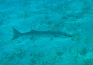
There is some risk that the anchor will become un-anchored.  Usually this is due to the anchor coming loose from the bottom, but it can be caused by a rope rode wearing through due to chafe and constant movement.  Of course, there are different kinds of bottom: sand is good, mud is good, grass is problematic unless the anchor punches through into the mud or sand below.  Flat rock is bad, and rough rock and logs can be bad since your anchor may stick too well and be impossible to get up.  Anchoring in the Bahamas is made easier since it is usually possible to see your anchor from the surface of the water, and observe how well it is dug in, and it is usually easy to swim down with a mask and snorkel and take a look.  Sometimes you can see your neighbor’s anchor.   Modern technology has come to the rescue with the anchor alarm.  This is a feature of all modern GPSs where you set a distance from “here”, and the alarm goes off waking you up if the boat goes farther than that distance.  We use a handheld Garmin GPSMAP 78 which uses about ½ Watt of power and which we leave on day and night.  I believe this device does more to improve the quality of our sleep than any other feature of the boat.

Calabash Bay, Long Island to Turks and Caicos – 48 hours at sea, 232 nautical miles

March 13, 2018

We have been reading “Passages South” by Bruce VanSant,  and one of his five rules is “plan your route flexibly”.  This is a prime example.  Last night we were anchored in Calabash Bay;  it was quite rolly, and Salli didn’t get much sleep.  The swell wasn’t forecast to improve, so we decided to stay another night in nearby Joe’s Creek.   After listening to the various weather forecasts, we pulled up anchor around 10:00 and headed for the creek entrance.  It was nearly low tide, there was an onshore SW wind,  and the creek entrance is about 4 feet MLW.  The closer we got the more this plan seemed to be a mistake, and we chickened out.  Our alternatives were, go back to Calabash,  go back to Salt Pond, or start out on our next leg East and South, and figure out our destination while we sailed.  This last choice is what we did.  As we continued on, the wind veered to the North, and conditions were good to just keep going.  We passed Rum Cay, Semanna Cay, Plano Cay , and  Crooked Island and Acklins Island.

In the vicinity of Plano Cay, we were visited by a small, beautiful, tired bird which we later learned was a Yellow Breasted Warbler.  It spent 30 minutes trying to find a place to rest, and we spent that time trying to keep it out of the cabin.  It appeared to have no fear of us, but of course, it was weighing the dangers of exhaustion against the dangers posed by us. “any port in a storm”.  After a while it took off and headed West.  We got to Mayaguana after dark on the second day, and it was clear that we had good winds to take us to Turks and Caicos around dawn which is what we did.  During the night we encountered a bit of commercial ship traffic, and the winds veered around a bit to the SE, causing us to bear up to a close reach, which made us take on quite a bit of water over the bow and motorsail.  Uncomfortable,  but safe.  We arrived in Sapadillo Bay around 10:00, anchored, took a brief rest, and put the dinghy together.

Turks and Caicos is a new country, so we rowed into the beach, and walked the ¾ mile to check in with Customs at the Port of Entry shipping terminal.  Shipyard security made us show identification, and wear fluorescent vests and hardhats.

Security office in shipping container

Security personnel were gracious enough to take our picture for us.  We had to clear both Customs and Immigration.   One office, but two officials.  The customs official took care of us, but we had to wait for the immigration official to return from a ship.  While we waited, the customs officer provided much useful info about our new home, specifically the currency (US dollars, they don’t print their own currency), and the Thursday night fish fry (highly recommended by everyone we talked to).   When we finished up, we walked back to the dinghy, buying 20 lbs of ice on the way, rowed back to the boat, prepared supper (barbecued chicken), and collapsed into bed.

Thursday, we rented a car, a KIA Picanto, so we could go to the Fish Fry, and do some shopping the next day.  The Fish Fry was nice, but geared largely toward tourists.  There was a band, an MC, and a traditional Junkanoo costume dance group.  There were many booths selling food and handicrafts.

Geographically, Turks and Caicos is an extension of the Bahamas with the same kind of islands and shallow banks.  Politically, they are a British Overseas Territory. As a British territory, its sovereign is Queen Elizabeth II.  At some point, T&C has made the decision to improve their economy by concentrating on tourism and offshore banking.  The result is an improved economy, but they have lost much of their island atmosphere.  The good side of this is that there is good shopping, in some instances nearly equivalent to the USA.

Friday, we took our rental car out to do some shopping, laundry, and a bit of poking around.  Sadly, we found the Conch Farm (the only one in the world) to be closed due to damage by the hurricanes last summer.  We accomplished our other tasks and got our rental car back by late afternoon.

Saturday,  a slow day at anchor, getting organized, doing blog posts, and checking weather.  It looks like we may go the 70 miles to the Turks islands in a couple days, and from there to the Dominican Republic a couple days later that that.

Overlooking Sapadillo Bay with goats

Georgetown to Thompson Bay (Salt Pond) Long Island

March 9, 2018

Weather is finally acceptable to make a break from Georgetown.  Sailed off anchor at 6:45.  Out the North Channel Cut (oddly the most South East of the Georgetown cuts).  We sailed in good wind until noon when we used a bit of motor.  Caught and (carefully) released a 3 foot barracuda. Arrived in our anchorage mid afternoon.  We went into town the next day, Saturday, and found a great grocery store and a great marine supply.  The town itself is a bit dreary, although they are gearing up for their annual Mutton Festival next weekend.  Too bad we will miss this, we both love lamb.

March 11, 2018

Wind from the South, exactly what we need to get north to the tip of Long Island.  We sailed 27 miles North to Santa Maria Bay.  This bay is purported to be the third landfall of Christopher Columbus, and there is a large monument here.  Unfortunately, the bay is exposed to the north and there was still a surge from the North, causing our anchorage to be quite uncomfortable.  We had a crew meeting and decided to move South to Calabash Bay in the hour we still had left before sunset.  We found conditions marginally better here, but still had a rolly night.

Calabash Bay sunset

Via Rudder Cay to Georgetown

Monday February 26, 2018

Our Friend

We headed to Rudder Cay this morning.  There were two very shallow places on this route which we took at low tide.  Our strategy was that that we could easily wait for high tide if we ran aground, but that didn’t happen. We are headed for Georgetown next, but it is a bit far for one day, so this trip brings us a few hours nearer to our destination.  Also the trade wind has been quite strong, causing it to be quite rough on the East side of the Exumas; it should be more pleasant tomorrow.  Rudder Cay has a unique feature:  Magician David Copperfield has placed an underwater life size sculpture of a mermaid and grand piano near this island.  The Lat and long are readily available, and we went over to see it.  There were several other boats anchored at Rudder Cay for the night.  A 30” Barracuda took up residence under our boat while we were at anchor; he was gone in the morning

Tuesday February 27, 2018

The next morning we left at dawn for a pleasant sail to Georgetown.  We sailed through Rudder Cut with three other boats, that were a bit faster than us, and gradually left us behind during the morning.  As the day progressed, the wind gradually died, and we started up the motor so we would get into Georgetown well before sunset.  We caught a 24” barracuda which we filleted and put in the icebox.  We got into Elizabeth Harbour around 2:00 and found an anchorage  near town sometime after 3:00.  After we were settled, we went into town to look around.  We ate at Eddie’s Edgewater, a local restaurant, bought some groceries and ice and went back to the boat.  The grocery store had a note in the rather bare produce isle saying the mail boat is coming tomorrow.

Georgetown is quite a phenomenon.  There are hundreds of boats here all winter long.  It is the terminus of the route taken by many boats that spend the winter in the Bahamas with no intention of going further south;  it is possible to get here, through Nassau, without sailing overnight .  There are big boats and modest boats, and boats that stay here all year long like vacation homes.  Georgetown is also the jumping off place for boaters going further south.  We happened to show up at the beginning of Regatta week, so there are all kinds of events:  dinghy races, local Bahamian sailboat races, Bahamas vs. cruiser softball games, Volleyball,  talent show,  church on the beach, The Bahamian Music and Heritage Festival, etc.  There is also an active cruiser’s net on VHF radio where events are coordinated, and equipment bought and sold.  We tried to find some charts here but didn’t have much luck.  After we got here, the wind picked up from the North, caused by the storm in the N Atlantic which brought hurricane force winds to the midatlantic states.  This storm also sent huge wave surges down here (up to 16 feet), so we will have to stay here for a while.

The town of Georgetown surrounds a saltwater lake called Lake Victoria.  This lake has a huge dinghy dock that can accommodate more than fifty dinghys.  The only way into Lake Victoria is through a small waterway, too narrow to row through.  This waterway has been cut out of solid limestone and has a bridge across it for Georgetown’s circular one-way road.  The lake is 2/10 of a mile in diameter, and has a tide of around 3 feet.  This volume of water goes in and out of this small cut twice a day with the tides, and sometimes is so fast that we can barely make headway against it when going into or out of town, even with our outboard motor.

Olive Oyl just off right side of pic


Between the Elizabeth harbor and Exuma Sound, is Stocking Island.  Visiting volunteers have made and marked a system of hiking trails, connecting the various features of the island.  We hiked over to the Sound (ocean) side on a day when the swell was running perhaps 10 feet, and there were great pipe shaped waves like Waikiki Beach.  We hiked up to the monument at the highest point on the island, and could look down on our boat, anchored among about 200 others in the lee of this island.

Big Majors Spot to Black Point Settlement.

Big Majors Spot to Black Point Settlement.

We spent two nights at Big Majors Spot, in the company of about 55 other boats, and moved on to Black Point Settlement on February 21.  The wind was blowing at 20 knots from the east.  We were able to sail for the first hour, and then had to motor almost directly into the wind.  There was some 2 foot chop at the worst, which brought quite a bit of salt spray on-board.  Sailing on the banks here is a lot like sailing in the more shallow parts of the Chesapeake Bay.

Black  Point is about the same size as Staniel Cay, but with less commercial activity.  Thursday, we took a short walk to see some blowholes, and a limestone arch.  We got free water near the government dock, and went to happy hour at Scorpios, with a bunch of other cruisers.  The bartender was quite liberal with the rum.  My theory is that, in the Bahamas, rum costs less than fruit juice.  We were strongly advise, by other cruisers, not to drink more than three.


Rockside Laundromat has 10 new washing machines, 2 showers, a small convenience store, and a dock.  Salli says it is the cleanest laundromat she has ever been in, even in the USA.

Sunset at Black Point


Staniel Cay

February 16, 2018

From Exuma Park, we decided to go to Staniel Cay.  There were two possible routes, in Exuma Sound (to the East) with big waves, and salt spray in our faces, or on the banks (to the West) with tiny waves.  We took the latter route in subdued winds making between 2 and 5 knots on a close reach.   This was a fairly easy sail with no difficult navigation.  We anchored in the early afternoon in 6 feet of water near the SCYC (Staniel Cay Yacht Club).   On shore to look around and get our bearings, and get a tourist map from the SCYC where we also had dinner.  Back to the boat.


Saturday:  Did laundry and visited the three food stores.    We snorkeled in Thunderball Grotto, where the James Bond movie was filmed.  We got there with the help (and dinghy) of our friends, Wayne and Brenda, from Caribbean Dream.  Saturday night was a fundraiser dinner at the government dock, attended by cruisers and locals.  Steak dinner with lots of fixings: $15.  Yum!

Sunday:  spent the whole day on the boat, reading about the Southern Bahamas, Turks and Cacaos, Dominican Republic, and Puerto Rico, and the various techniques for getting from one to the next.  We moved the boat about 50 yards to give us more depth for the coming wind.

Monday: listened to Chris Parker tell us the good news that, starting next week, the strong easterly trade winds should let up for a week, likely for a month, letting all us cruisers head East and South again.  Yippee!

We watched folks pet, and feed squid by hand, to 20 nurse sharks at the yacht club.  In the afternoon, we moved about two miles to Big Majors Spot, where there is better protection from the wind, forecast to gust up to 30 knots for the next few days.


This is also where there is a beach where pigs roam the surf, looking for handouts.  We went ashore, and fed them some carrots, old grapes, and our brussel sprout trimmings from last night’s dinner.  They are fairly competitive with one another, and one started to climb into the dinghy before we were firmly on hard sand.  Fortunately, I had an oar handy to prod her back into the water.

There is a commercially driven name-creep down here.  Before the movie, the grotto was called “The Grotto”, and before the pigs, who knows what the name of the bay was, but now they are Thunderball Grotto and Bay of Pigs, printed right there on the charts.

Exuma Land & Sea Park

February 13, 2018

We left Rock sound Harbour at 4:50 AM, and sailed out of the harbor in the dark.  Our route took us through the Davis Channel and out into Exuma Sound (1600 feet deep) and on to Warderick Wells Cut and Warderick Wells Cay.  We did this under fairly brisk winds of 15 to 20 Knots on a broad reach which carried us along at the respectable speed of 6 to 7 knots, getting us in at the respectable time of 2:00 PM.  Waves gradually increased during the day from not much to about 6 feet.  Very rolly, but bearable.  Neither of us got seasick, although we were plenty tired when we got in.  Warderick Wells Cay is the headquarters of the Exuma Land & Sea Park, a 176 square mile park where hunting and fishing is prohibited.

Warderick Wells Cay is clearly the most beautiful place we have been to so far.  There is a half moon anchorage with the bluest water you can imagine.

Emerald Rock

Christmas Tree Worms

We hiked the trails, and snorkeled two of the reefs.  The second day we were here, the boat at the next mooring attempted to leave at low tide, gave us too much room as he passed us, and ran aground.  Of course, BoatUS doesn’t come out here, so he was of his own, except for several of the other cruisers who dinghied over and offered advice.  After trying a few things, he ultimately opted to wait a few hours for high tide, and to float off (Salli’s suggestion).

Salli organized a pot luck dinner on a sand beach which included a display of a sperm whale skeleton.  Very Cool.   There were no supplies here, and no place to offload garbage.  We spent three nights here.

Rock Sound Harbour

February 7, 2018

The next day, after a leisurely breakfast, we again sailed off our anchor, and headed South.  On the radio, we heard two boats talking, and we knew one of them, Brynli.  It turned out that they and two other boats were sailing to Rock Harbour too, and were approximately where we were.  We could see each other, so our sail turned into an impromptu race with Olive Oyl (the smallest) placing last.  It was a glorious sail with blue skies, and strong winds.  Six and a half hours after we started, we were dropping anchor in Rock Sound Harbour near a white sand and stone beach.

We stayed at Rock Sound Harbour for six days.  People were very nice here too.  The waitress at Sammies, had a cousin who cut hair, just what Salli needed after three months;  the cousin picked her up at the beach in her car.   There are several blue holes in the area which connect to the ocean to the East.  Some are large round holes in the ground with mostly straight sides, much like huge swimming pools with no bottom.  There are also blue holes in the bottom of the harbor.  The chart advises not to anchor in one.  We swam in one that was less than a mile inshore from our anchorage.  Lots of fish that came over to be fed.

There are caves here near the water about one mile from where we were anchored.  A group of us tried to find them.  We thought we were getting near, when one of our party flagged down a passing car.  The woman driving, didn’t know, but called someone who did.  He gave directions, said he hadn’t been there since he was 16, he was now in his 70s.  They were very interesting caves, with holes at the top, open to the sky, and 40 foot roots growing down to the cave floor.


One day we were walking across the island to see the ocean beach (about 2 miles), and a woman stopped and offered a ride.  Her name was Rosie, she had a nice place on the ocean side where she sometimes produced meals for tourists.  When we were done, she drove us back giving us a lesson about the local foliage, especially how to recognize Poisonwood, a poison ivy-like woody plant. We topped up on groceries, gasoline ,ice and water in preparation for the next leg.


Spanish Wells to Alabaster Bay

February 6, 2018: 38.4 miles. About midway on this trip, we had to pass through Currrent Cut. This is an East-West cut through the main island of Eleuthra which can have currents of 10 knots to the East, and 7 knots to the West, depending on the tide, both faster than Olive can motor. It was hard to get accurate tide information here, and harder still to get current info. What we did find was that high tide on the west side of the cut was 1 to 2.5 hours after high tide in Nassau, and that minimum current was 2 hours later than that. This would be about 4:20 PM on the 6th, which was a bit too late to get anywhere before dark. We figured that since 4:20 would be slack current, that maximum current to the East would be three hours earlier or 1:30, and there would be another slack current at 10:30, three hours earlier again. We would expect current in the direction we were traveling for the entire time between 10:20 and 4:20. So we tried 10:20 and things worked out fine. We had a bit of a current with us (perhaps 3 knots), and we got to a nice anchorage, Alabaster Bay, about 30 minutes before sunset.

Spanish Wells

Thursday – Friday February 1 – 2, 2018

Finally leaving Marsh Harbor, Abacos to go to Spanish Wells Eleuthera:  Originally we intended to do this as two long day sails, anchoring overnight near Little Harbour.  The wind Thursday was forecast to be 15+ knots and Friday to be light and variable.  We sailed (with sails) from our anchorage in Marsh Harbour, all the way to Little Harbour, which took us until mid afternoon.  We decided to keep sailing for two reasons:  1) We wanted to take advantage of the wind Thursday rather than motoring on Friday, and 2) We would arrive at our destination in the morning with no chance of arriving after dark,  allowing good visibility to negotiate a shallow approach.

The sail from the Abacos to Eleuthera involves going through a cut (in this case Little Harbour Cut) into  the Atlantic Ocean for 50 nautical miles, and back onto the Eleuthera bank  near the more protected Egg Island.  There are two considerations:   We have been navigating on the Abaco banks for two months where the depth is seldom deeper than 12 feet.  This reduced depth also means the waves can only get so big.  In the Ocean, the depth is greater (3500 feet in this case) and waves can get much larger.  In addition, when transitioning from the banks to the ocean, we have to go through a cut, where current, wind and waves sometime conspire in unforeseen ways.  In any case, we got a favorable forecast, and talked to a boat that was out in the ocean, and we decided to go for it.  To make a long story short, we encountered 5 to 6 foot waves in the cut, and waves gradually decreasing through the night.

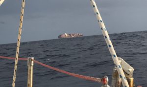
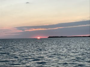
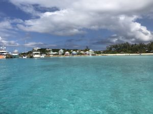
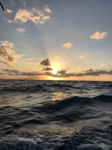
We kept short 2 hour watches and both got some sleep during the crossing.  As we approached Eleuthera, the wind started veering (moving to the right), so we couldn’t maintain our direct course.  When the sun rose in the morning, we were 10 miles from Egg Island with calm seas.  We started our engine and motored two hours to Egg Island, and another hour and a half to Spanish Wells to anchor just west of their harbor,
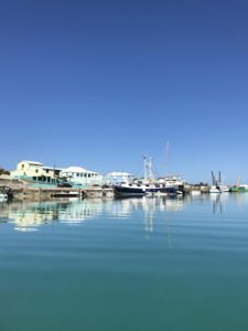
We rather liked Spanish Wells.  People were very friendly.  When we stepped ashore, we were looking around trying to decide what to do first, when an elderly gentleman approached us in a golf cart and offered to give us a tour of the island. There would be no charge.  We climbed aboard, and he (Captain Edison Byrd) gave us a tour of the islands two main roads from one end to the other.  He told us a bit of the history of the island, and mentioned that during WW II, Bahamians were agricultural work in the US to take the place of farmers that were fighting in Europe and the Pacific.  As we passed one shop Capt. Byrd told us that his daughter worked there.   He is 91, has lived in Spanish Wells his whole life, and a retired sea going captain.  He has spent the last 18 months giving visitors free tours and general transportation.  His daughter later told us: “He can drive and he can talk”.  This was a great introduction to Spanish Wells.  We ran into the Captain two more times, each time he told us about going to Wisconsin and doing farm work.

Captain Byrd

The primary industry of Spanish Wells is fishing, mostly crayfish (spiny lobster) fishing.  It is apparent that they make good money doing this, as the boat gets $12 a pound for their catch.  There is a marina , a mooring field, and a boatyard, but there is very little attention given to amenities for cruisers.  There was no specific dinghy dock, but one clearly gets the impression that folks are quite reasonable, and for the most part, don’t really care where we dock.  One afternoon, during a full moon, we went back to our dinghy and found it way below the dock riding on an especially low tide.  I was able to get into it, but Salli, being much shorter was wisely unwilling to try.  No problem, I will take the dinghy, and we will find a place with a long ladder to get her on board.  Unfortunately we were unable to find one nearby.  A local man seeing Salli, asked to help, offered to take her in his car to the other end of the town, and when she deferred, went anyway in search of a good location.  Another man suggested that she climb down on a nice looking motorboat that had a platform just perfect for boarding the dinghy.  Salli asked him if it OK, and he said “use this boat”.  She asked if it was his boat, and he said again: “I’m telling you to use this boat.” And he helped her to get on it.  The implication being: “I don’t know whose boat this is, but this is Spanish Wells and no one will object to a stranger crossing his boat to get to his own boat.

We spent several days here, met two visiting couples with an astonishing number of things in common with us, Took the high speed ferry to Harbour Island, a Bermuda-like tourist stop with a spectacular beach,


and shopped in the excellent Spanish Wells hardware stores.